Bangalore Smart Cities Metro Route Map Image
The Bangalore Smart Cities Metro Route Map outlines the metro lines across the city, providing a comprehensive view of the interconnected network. Key lines include the Purple Line, Green Line, and upcoming Yellow Line, facilitating efficient travel across major hubs like Majestic, MG Road, and Electronic City. The map enhances urban mobility by integrating with bus and feeder services, offering a seamless transit experience. It is crucial for commuters, aiding in effective travel planning and reducing traffic congestion in Bangalore.


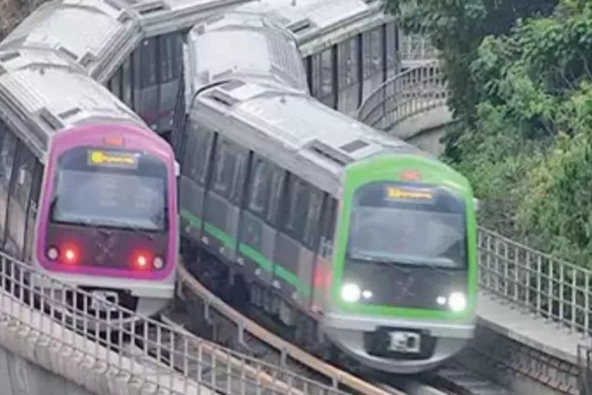
Bengaluru the city known as Silicon Valley came up with one of the best modes of communication the metro, the project development team has given many new to the congested city where traffic is a nightmare. Now, it is being transformed into more modern and sophisticated developments. The city is one of the first to give helicopter ride from the city to the airport for those who wish to reach the airport. Those who wish to catch the train they will get direct connectivity to the airport towards Yeshwantpur junction. But certainly the icing on the cake is Bengaluru Metro which has given the people of Benngaluru to traverse within the pleasant condition of weather. The city makes you feel great with the food, culture and developments in tow.
Bengaluru Metro also known as Namma Metro is an urban rapid transport system that is as fourth largest operational metro network within India. The metro project has two phases of development that cover the entire city. This makes it with people to get better understanding of the route map where you get the best out of the preferred metro connectivity. The metro after missing a few deadlines first sections finally opened with inauguration on 20 October 2011. It was given an overwhelming response from the public who took the ridership to a higher level. As per BMRCL sources the first 3 days of operations 169,019 people took to the metro. From then onwards there is not a single day when people could not be seen flocking to the metro for a comfortable ride.

Bengaluru Metro comes with two operational lines Purple and Green with 51 stations. It covers a length of 72.17 km.
It comes with 6 under construction lines that have 68 stations and with length of 39.296 km.
Bengaluru Metro has come up with huge ridership with 6.88 lakh passengers on an average per day in December month. Purple line development is running between Challaghata and Whitefield and is operational. BMCL has begun with land acquisition for phase-3.
Bengaluru Metro has also the 2ndmetro system within India. It employs the ATO technology with the upcoming yellow line. It is with an introduction to innovative services which comes as Group QR. It has become an attraction, a necessity, and a symbol of development with ease for commuters. The development gives the 2nd metro system within India to employ the RTO technology with the upcoming Yellow line. It has introduced innovative services such as Group QR and increase the number of trips within the city limits.
Bengaluru Metro is 2nd metro system in India that employs the ATO Technology to the upcoming Yellow line. It also introduce innovative services as Group QR is the new technology introduce with the metro services. BMRCL is the governing body of Bengaluru Metro with a joint venture of the Government of India and Govt of Karnataka.
Phase 1 of Bengaluru Metro has a total cost project of Rs 11,609 Crore. It has a total number of stations of 41 and a total distance of 42.42 km. The number of corridors is two.
It has Corridor 1 with a Purple line from Baiyyappanahalli to Mysore Road. It has a total length of 18.22 km and covers 17 stations. It covers almost all stations on this route.
It has corridor II with a green Line from Nagaendra to Yelachanhalli. The total length is 24.20 km. it covers stations as 24 numbers this shows the intensity of the entire line covering all important stations.
It has Corridor –I with the purple line as Baiyyappanahalli to Mysore road. The total length of the project is 18.22 km. It covers all the stations as 17. The metro stations are 17 which gives a great way to travel between all the important destinations of yours on this route.

Corridor II is with the Green line with Nagasanndra to Yalachanahalli. It comes with a total length of 24.20 km. The project connects with covering 24 stations.
Phase II with Bengaluru Metro
The total cost of the project is with Rs 30,000 Crore. This is going to be one of the major routes as the number of stations is 62. It comes with a total distance of 73.921 km. The number of corridors with Two new lines and 4 Extensions makes it a project that adds a good distance to cover with all comforts. 74 km of line is a huge distance that will give a new face to metro services.
It comes with new lines with Corridor III that has Yellow lines on RV road and up to Bommasandra. The total length for the project is 19.143 km which will get an elevated course. It covers 16 number of stations. It covers 16 number of stations. The project is still under construction.
Corridor with number III with Yellow Line to Bommasandra. The total length is with area of 19.143 km. It covers several stations as 16. There are a huge number of stations on this route although it is only 16 km. The project is still under construction.
Corridor IV with Pink Line that is between KalenaAgraha which is formerly GottigeraNagawara. The total length is 21.386 km that is elevated as well as underground. It covers a huge number of stations as 18. The number of stations is 16. It covers a huge number of stations on this route.
Line 1 with Purple Line is from Mysore Road to Chaliaghatta. It has a total length of 8.814 km which is on an elevated line. It covers total number of stations as 7. It covers an operational line.
Line 1 is a Purple line. It connects from Baiyyappanahalli to the posh location of Whitefield. It has a total length of 15.257 km which is on an elevated line. The number of stations it covers is 13. It has an operational line which covers all stations on this route.

Line 2: It has a Green Line from Mesaraghatta Cross that was formerly known as Nagasandra with Madavar that is formerly BIEC. It has a total length of 3.031 km that is on an elevated line. It covers 3 stations on this route. The project is under construction.
Also Read :
Operational lines on Bengaluru Meto or Namma metro are:
Line 1 known as the Purple Line is from Challaghata to Whitefield (Kadugodi). It covers a total distance of 42.17 km and has 37 number of stations.
It has Line 2 on the Green line which covers distance from Nagassandra to Silk Institute which is 30 km and has total number of stations of 29.
The under-construction lines are with Phase 1, Phase 2A, and Phase 2B.
Line 2 is with a Green line from Silk Institute to Anjanpura Depot which comes as 6.50 km and still has 0 stations in between.
Line 2 as Green Line with Hasaraghatta Cross with Nagasandra to Madavar. It has with area of 3.031 km and connects with 3 stations.
The Line 3 has a Yellow Line which connects from RV Road to Bommasandra with area of 16.143 km. It has total number of stations of 16 stations.
Line 4 gets the Pink Line from Gottagra which is KalenaAgrahara to Nagawara 21.386 km. The project adds 18 stations in total.
Line 5: The blue line has connectivity from Central Silkboard to KR Puram. It connects with a distance of 18.236 km with 13 stations.
Line 5 as Blue line with K R Puram to Hebbal – KIAL Terminals. It has a distance of 37 km with 17 stations that are up to the Airport line.